

Description
Updated edition. Detailed topographic map 1:75.000 for hiking and trekking, printed as an atlas book (with overlapping pages).
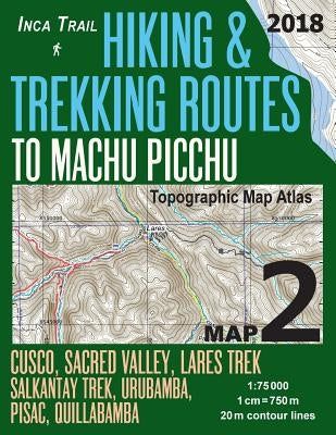
Covers the area around Cusco, the Sacred Valley and the various trekking paths from the Sacred Valley villages and towns to the Machu Picchu complex, including Lares treks, Salkantay trek from Mollepata, etc.
20 meter contour lines, road network, trails & paths, transportation, food, campsites, shelters, guest houses & hotels.Mercator projection with both UTM and WGS84 coordinate grids.
The map scale of 1:75000 (1 cm = 750 meters) provides a wealth of detail while keeping low the weight of the atlas itself. The large page format of 8.5x11in minimizes page count and along with an overlapping map design allows for comfortable navigation.
The details included in the topographic maps of this atlas were specifically selected to be useful for trekkers, hikers and walkers of all interests, and make it easy to plan and enjoy both short excursions and hikes as well as long multi-day adventures along the main marked routes and/or adjacent trails and paths, which are also shown on the maps.
With this ultralight atlas you will always have a detailed, reliable, information-rich, battery-independent, shatter-proof map for your adventure.
Author: Sergio Mazitto
Publisher: Createspace Independent Publishing Platform
Published: 02/22/2018
Pages: 44
Binding Type: Paperback
Weight: 0.37lbs
Size: 11.00h x 8.50w x 0.11d
ISBN13: 9781985780545
ISBN10: 1985780542
BISAC Categories:
- Travel | South America | Peru
This title is not returnable